Alaskan Sampler - Fairbanks
Day 4
We're were told that Fairbanks, a city of 30,000, is the "real Alaska." Anchorage is just another Seattle. We begin exploring at the University of AK Fairbanks museum with displays of a glacier bear (black bear in the blue phase), a 36,000 year old bison recovered from permafrost and a giant brown bear. Featured exhibits included displays on pioneer women who helped establish Alaska as we know it, mammoth tusks, minerals and Indian and Eskimo artifacts. Kevin attends a wolf program while I lie down with a headache. We go by the Georgeson Botanical Gardens at UAF's Experimental Farm but leave when the rain gets hard.
Showers at a laundromat almost scald with hot, hot, hot water, and Kevin calls home. We're keeping late hours and are asked to remember that there's a two hour time difference between Alaska and Colorado.
We find a public lands information center ½ hour before it closes. Lots of maps, books. We buy a public lands campground map. A bargain at 25 cents.
A quick stop at Alaskaland confirms that it is the tourist trap it sounds like. They do have some interesting old equipment including a crane used in building the Panama Canal and early mining equipment.
On to the Chena Pump House Restaurant for dungress crab, halibut, crab cakes and the best cream of potato soup and clam chowder we've ever had. A feast after our quick dinners of Rice a Roni and spaghetti.
Eastward, the Chena Hot Springs Road is defined by frost heaves. Up and down and up and down. Mailboxes are decked with flowerpots. We sleep at the Chena Dome Trailhead in Chena River State Recreation Area. Lots of trees and horsetail moss; kind of pretty. Rainy.

Day 5
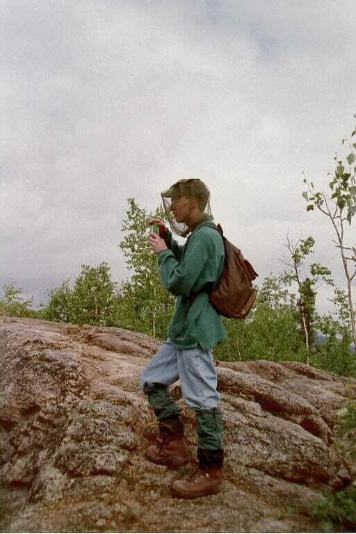
The Angel Rocks Loop trail begins with a mile long trail that is first muddy, then turns rocky and finally steep.
We later identify low bush cranberry (Lingonberry), blueberry, crowberry, bear berries, timber berries and finally Canadian dogwoods (bunchberries) from samples of berries along the trail.

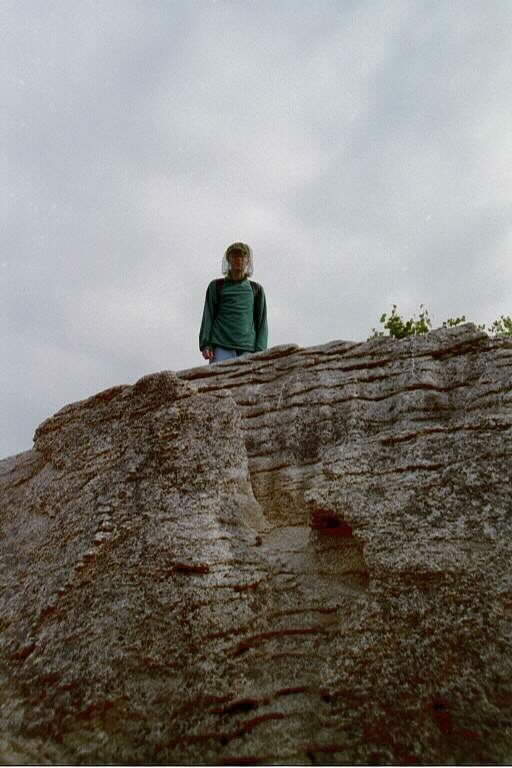
Photo by Kevin McBryde
Granite outcrops (tors) were formed millions of years ago when molten rock pushed upward, cooling before reaching the surface. The surrounding earth has since eroded, exposing the harder rock pinnacles. We're rewarded for our efforts with some great views from the top of these tors.
Traveling back through Fairbanks we gas up at Tesoro, a service station chain we will forever equate with all things Alaskan - they must have bought out or been franchised by every mom and pop gas pump in the state. Its distinctive blue pumps and canopies are as much a part of the landscape as the colorful espresso huts sporting large ice cream cones found in the liquor store parking lots.
We retrace the Parks Highway (named after George Parks, the highway engineer, then governor, then state engineer again) back to Cantwell and turn East on the Denali Highway (this is named after the old town of Denali, not the park or mountain).
© Regina M. McMullan, 2000